Business

Cloudpoint From Home

Cloudpoint From Home

We are all working though these confusing and trying times to find a new normal. There is a plethora of advice for not going crazy and a few tips from other GIS Professionals. I thought I’d share how Cloudpoint Geographics has managed and migrated to a distributed workforce while continuing production on essential projects and even expanding..

Shadow IT & Shadow GIS

Shadow IT & Shadow GIS

There are two meanings here: 1. You might be building your GIS as Shadow IT, know the pitfalls and realities. 2. Beware your GIS 'clients' may be building Shadow GIS underneath you. 

Shadow IT is a real thing. It's talked about at conferences and even has a Wikipedia page. Essentially, it is when 'unofficial' tech infrastructure is built in parallel to the official IT department; sometimes sanctioned, sometimes not. GIS could exist as a Shadow IT in both positive and negative way

Leaving a legacy: Preventing the loss of Tribal Data.

Leaving a legacy: Preventing the loss of Tribal Data.

As employees accumulate years on the job, they begin to build up an internal database of information.  A common term for this is Tribal Knowledge. Tribal knowledge is used to describe the wealth of data that a long time employee has developed, obsorbed, and retained over time. This is a fantastic resource for your organization which can....

All Moved In (Guest Writer)

Below you'll find an article in our local paper from Journalist Cheryl Wolfe of the Pantagraph papers in Bloomington, Illinois. She did a fantastic job and we wanted to include her article in our blog as a "Thanks!". 

(Reprinted with Permission)

ALL MOVED IN--Employees at Cloudpoint Geographic, Inc. are: (left to right) Jodi Hoffman, Paul Stephenson, Micah Williamson, Joe Christian, Matt Junker, Tyler Severson, and Jonathan Hodel

ALL MOVED IN--Employees at Cloudpoint Geographic, Inc. are: (left to right) Jodi Hoffman, Paul Stephenson, Micah Williamson, Joe Christian, Matt Junker, Tyler Severson, and Jonathan Hodel


 Cloudpoint Geographics moves to new office


Hodel plans open house
CHERYL WOLFE

cwolfe@mtco.com

 ROANOKE—These days, Jon Hodel often has his head in the clouds and is always thinking higher.

When office space for his growing business, Cloudpoint Geographics, Inc. got too small, Hodel started looking for something bigger. He found it, just a block away in the building that formerly housed Dr. Michael Meier’s dental office.

A building with several smaller rooms might not fit the needs of most businesses, but for Hodel and his employees, it was literally a godsend.

“This office has been a perfect fit for us,” Hodel said of the building. “The Lord provided for us; we couldn’t have asked for a better fit.”

Hodel said it was getting crowded in his old office on Main Street, but now all employees have their own space, in addition to a conference room and a kitchenette. And, the move kept Hodel’s business in his hometown, just where he wants it to be. There was a time when Hodel was thinking of re-locating to another town because he could not get enough high speed Internet service in Roanoke, a service that is vital to his business. But he recently found a way to get by with the service in place.

 “We don’t have fiber yet due to the cost, but we’re using the Amazon cloud, and we’re getting by for now,” Hodel said. “We have seen increased efficiency, and cost savings came into play.”

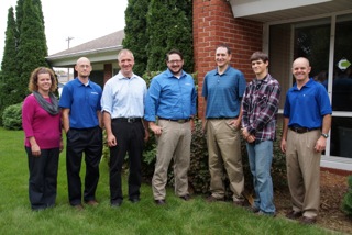
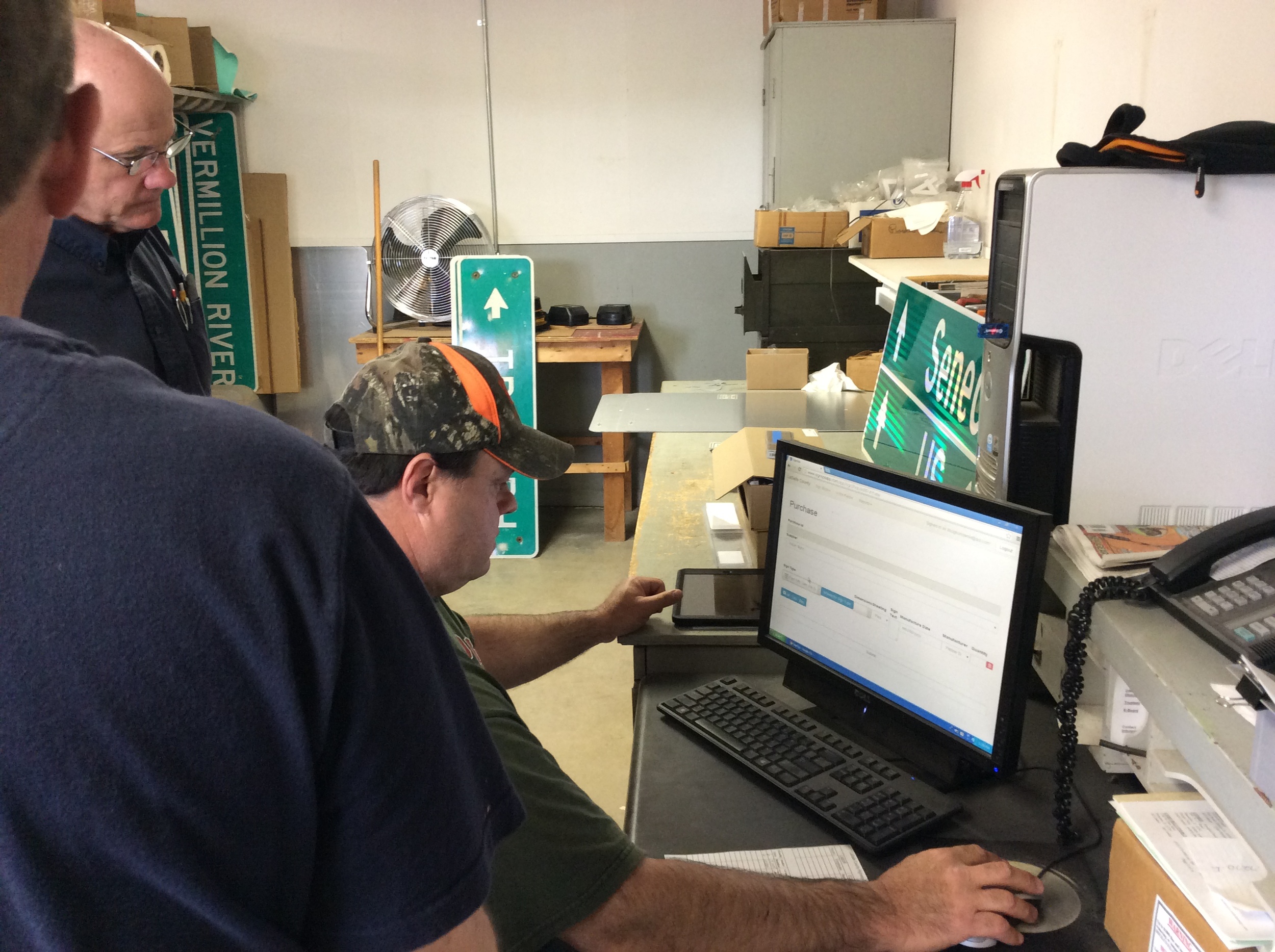
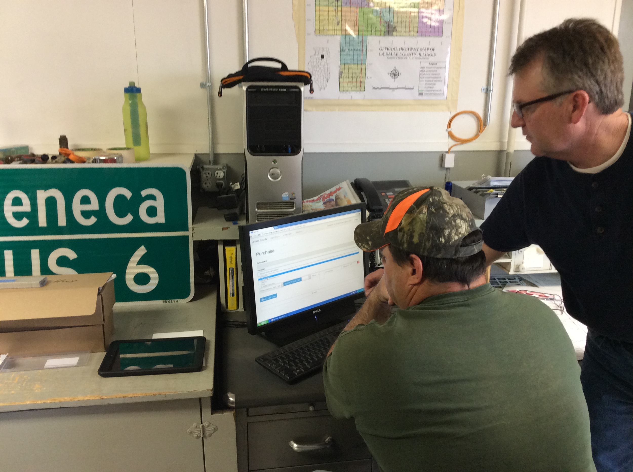
Most people don’t really understand the kind of work Hodel does unless they are very technologically savvy. Hodel is a licensed professional engineer and certified Geographic Information System (GIS) professional. His business started with him, by himself in an office with a laptop, and grew to where it is today with one part-time and five full-time employees. Their work includes GIS mapping for government utilities and public works and asset management, among other projects. Simply put, they make maps, Hodel said. But the maps are not simple.

GIS maps are detailed and made using satellite technology. They allow clients to visualize, question, analyze and interpret data to better understand patterns and trends, as well as what is happening in geographic space. They are also valuable in creating and maintaining more accurate records.

There is a growing interest and awareness of the economic value of GIS. It can be used to manage assets, such as the life expectancy of streetlights or to schedule garbage truck routes to maximize efficiency in fuel and labor. Cloudpoint performs both small jobs and big ones, like a utility mapping job in Mendota that has taken all summer.

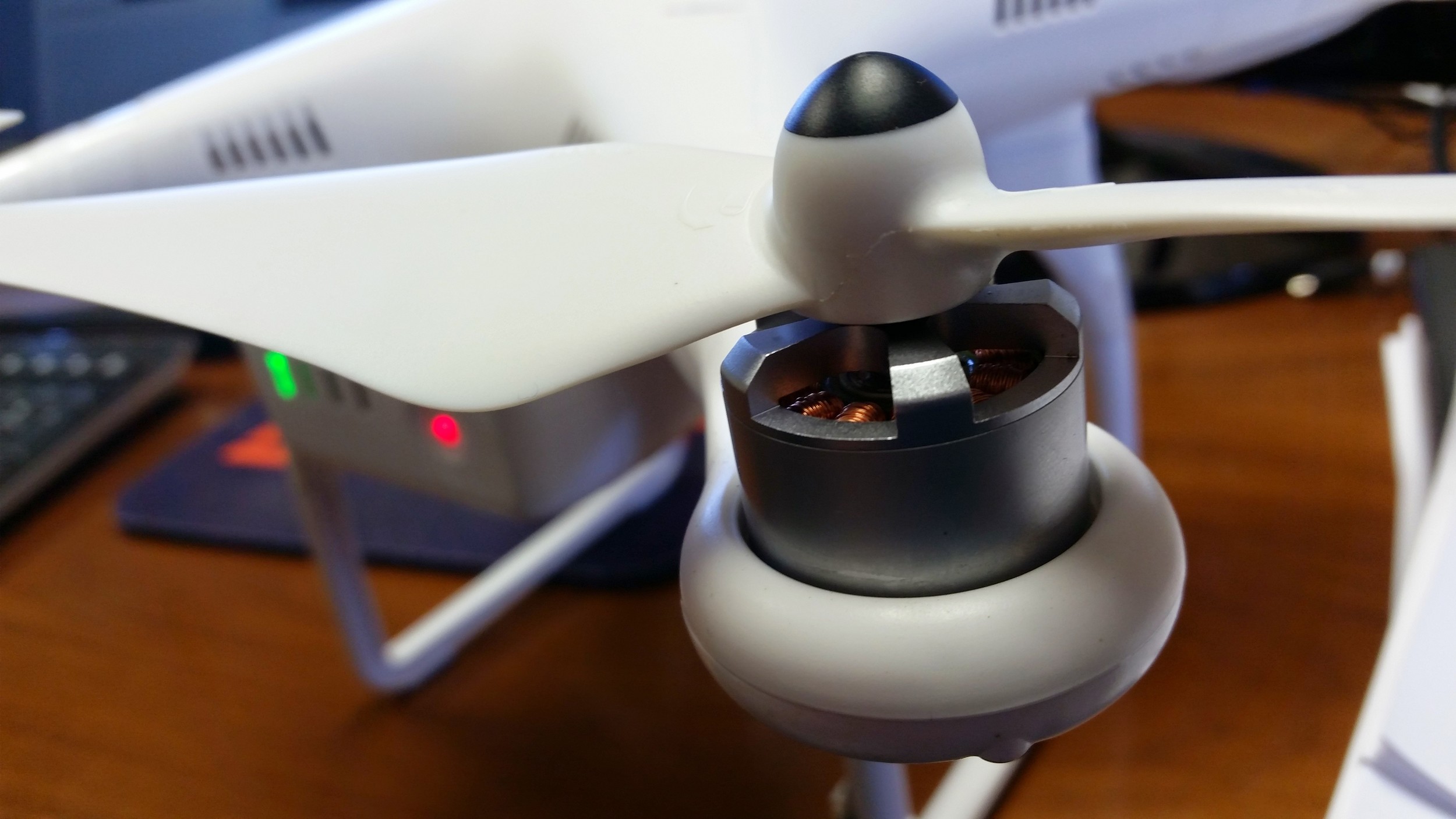
These descriptions are only a fraction of the work that Cloudpoint is capable of doing, and they barely scratch the surface of what will be available in the future. Hodel said drones will be used as a powerful commercial tool in the future pinpointing a number of things, from agriculture applications to other commercial uses. He plans to be a part of that technology as it is implemented.

”We’re really excited about the new technology drones will bring,” Hodel said. “It’s fascinating. I really enjoy new things. It’s the engineer coming out in me.”

Hodel said he hopes to hire a licensed pilot to work with drones in the future to create another arm of his business.

The work of Cloudpoint Geographics is far above most of the public’s head, so getting his name out and helping others learn about the services he provides to gain new business is sometimes challenging.

“We find we do a lot of door knocking, and use our web presence,” Hodel said. “Most of our business comes from referrals or face-to-face marketing.”

Hodel wants to do a little face-to-face marketing with the people of Roanoke where he has lived most of his life. He has invited them to come see his new office during an Open House, on Friday, Oct. 2, from 4-6 p.m. He will be glad to explain some of the fascinating aspects of his work to anyone who is interested. And, he wants everyone to know how much he enjoys his new office in Roanoke.

“We’re really happy to be here,” Hodel said.

Precision Hawk Partnership.

We know geo. 

Our staff are experts when it comes to street signs, Utility Mapping, ArcGIS Solutions and Enterprise GIS services. 


THAT being said, we also know a great company when we see one that is even more niche than ourselves. To enter into the field of Unmanned Aerial Systems, earlier this year we already announced our partnership with David Kovar as a FAA exempted and licensed pilot. Now to take it one step further, we are proud to announce a new partnership with Precision Hawk one of the premiere UAS companies in the world as a reseller. 

This relationship is beneficial to both Cloudpoint and Precision Hawk. It expands our offerings and allows us to provide for our clients a complete UAV solution. In turn, of course, we will be promoting the Precision Hawk Lancaster platform. No more sitting on the sidelines, no more wondering what will shake out, This is the direction that we are taking for remote sensing and UAS data collection. And we couldn't be more excited. Their Brochure explains a bit more what they do. 

PrecisionHawk is an unmanned aerial systems and remote sensing company founded in 2010. The company provides an end-to-end solution for aerial data gathering, processing and analysis to provide actionable information to clients across a wide range of civilian industries. The team is comprised of professionals with backgrounds in remote sensing, unmanned aircraft operations, software development, data processing and GIS systems development. The company operates out of offices in Indianapolis, Ind., Raleigh, N.C. and Toronto, Ont.

For more information See our Partner Page

Opening an Online Store

Cloudpoint team members are awesome.

You'll pardon me a bit to divert from the normally technical nature of this blog to talk about the folks who make up Cloudpoint Geographics.  Remember when you were proud of your school or some club & wanted to wear a t-shirt with a big logo on it? Hoping that someone would ask you about it and you could tell them how awesome it was? 

Our staff was asking for the same thing. Sure, we provide a stipend for team members to purchase nicely embroidered clothing for meetings with clients or standing at a conference booth.  But they want "swag".  We all have access to the folder of images with our logo, there is no proprietary logo-czar here. However, in an effort to be as productive as possible no one took the time. Well, now we did. Welcome to the Cloudpoint Geographics Store:

Check back often and frequently, I'm sure there will be additions, subtractions and more funny geography t-shirts than you could shake a locating rod at.  


A Look Forward: No Predictions, Only Productivity

Don't fall into the trap of thinking you know anything about the future. Sure, There's lots of neat confucus-iy quotes about knowing the future from learning about the past, or whatever. I've succumbed to the temptation myself to guess what will happen in the next 5 years. Here's the real deal. You can only control the "now".  Even then just a little tiny corner of your world. The future is ever changing,  take a lesson from Yoda.

Here at Cloudpoint, we are developing Principals to work by and not procedures or policies. We have no employee handbook or workplace guidelines. Even if we did it would be filled with bullet-point list of adages. For Example:

despair.com

  • Be Professional.
  • Work Hard & Be Nice To People.
  • Are you Productive or Just Being busy?
  • Make it Better. 
  • Why are you here?
  • When the door is shut, don't bother me.
  • Never Stop asking Questions.

When you feel like you can (or try to) predict the future, your pride gets in the way of actually making it happen. Somewhere inside you become a spectator watching life rather than a participant in it: "I knew this was going to happen!" Not helpful. A bit of personal humility can go a long way when you are assisting people with a new technology. Rather, when you set attainable goals you set a standard for yourself, a personal guideline. American author Mark Batterson once said (paraphrased): 'Goals are Just Dreams with Timelines' Well Said, Everybody needs dreams. 

This is what 2015 looks like for us. These are our genericized Goals: 

  1. Increase Benefits to Team Members
  2. Expand our Territory
  3. Hire
  4. 7+ Speaking Engagements
  5. Learn New Software
  6. Read 13+ Books
  7. Freely Distribute Several Useful tools
  8. Centralize Cloud Offerings 

There are others that I'm not willing to share, but this is most of the list from our first 2015 staff meeting. Some of them are personal, some are corporate all are real and attainable. 

Don't let the lure of trying to predict the future fill you with apathy and pride.
What are your goals? 

A look back: Cloudpoint's 2014 Year in Review

First Flight: We've come a long way from Kitty Hawk, NC

 First flight of the Wright Flyer I, December 17, 1903, Orville piloting, Wilbur running at wingtip.  http://en.wikipedia.org/wiki/Wright_brothers


First flight of the Wright Flyer I, December 17, 1903, Orville piloting, Wilbur running at wingtip.  http://en.wikipedia.org/wiki/Wright_brothers

 A close up of one of the props on Cloudpoint's first quadcopter which was later dubbed "Icarus".


A close up of one of the props on Cloudpoint's first quadcopter which was later dubbed "Icarus".

It's been over 111 years since the birth of powered aviation and its amazing to think of where we've gone.  Cloudpoint conducted its first successful GPS-guided aerial mapping test flight on June 9, 2014 at the Roanoke Apostolic Christian cemetery.  Height: 150 ft, Speed: 6 mph, Flight time: 8 minutes


Mapping at Sonic Speed

 Cloudpoint's new Chevy Sonic with almost the whole crew loaded inside.


Cloudpoint's new Chevy Sonic with almost the whole crew loaded inside.

In July we purchased our first company vehicle, a Chevy Sonic, from Sam Leman in Eureka, IL.  The logo and lettering  by Kat-n-Mouse Graphics of Roanoke.  This has been a great vehicle for us as we put many miles on traveling throughout the state to our various clients.


Signs of Success

On May 1 we successfully rolled out our first custom application solution called SignOps, a sign inventory management solution using barcode tags for asset management.  LaSalle County was the first project where we tagged over 6,000 signs with barcodes and provided a complete turn-key mangement solution with the SignOps application.

What is a 'Location Strategy'?

Sounds like a buzzword.

Yeah, it is, So? The point of buzzwords are to create buzz around a specific topic or idea. 

Therefore; The idea of conceptualizing your organization's Location Strategy is to get you to think about location. Some of the worst business advice is given by Hollywood; "If you build it, They (he) will come". Not necessarily.  Here's some questions to start you off: 

  • What would happen if you moved your office/business?

  • Is it important to know the location of your employees? 

  • Is it important that they know where your inventory (Stuff) is?

  • Do YOU know where your inventory is? How about your replacement?

  • Can your clients get to you? 

  • What about social media?

  • How close are you to your most valuable clients?

  • Are you causing your clients frustration because you haven't though about this?

Let me give you two examples

1. Bob the Restauranteur, He makes truly awesome Pizza, but never gave a thought to location. So he opened up his shop in his hometown. He has a short commute but he drives an hour everyday to get fresh ingredients. His little town already has two pizza places, but he has low-overhead, so he stays. He has a great website, but it's not mobile enabled. His kid brother is the delivery man, who seems to deliver a lot of pizzas to his friends outside town. Yelp had a few bad reviews of Bob's delivering brother.  Bob lasted 9 months then went out of business. 

2. Sue the City Administrator, works in the same town as Bob. But she HAS thought about Location, a lot. Infact she regularly updates her digital infrastructure (GIS) on an iPad when sewers get fixed or installed. She also keeps up with her field folks sending them paperless work-orders based on a mobile-enabled app from the general public, which are her 'customers'. She has claimed the locations of city hall on Bing and Google maps, Yelp, Foursquare, and a host of other social media. Sue is 63 and almost ready to retire, so she's training the current public works director to do all of this and sends him to lots of conferences. 

A good location strategy is beneficial to you presently and those around you in the future. With these little self-aware computers we all have in our pockets, location is common. Someone will think about your location if you don't. My advice to you is get in front of the tide. Think of some of the most effective companies; Walgreens, McDonalds, Wal-Mart, Casey's General Stores. These guys know the value of a good strategy. Location, Location, Location. 

Share Your Workplace Workspace

Everybody wants to be known.  Every desk has a view

We all have a workspace and every workspace has a story. I'm not talking about a file workspace, or ArcInfo workspaces. I'm talking about literally where you sit to work. We want to know about it, we want to see it, we want to know your story.  GIS people -to- soccer moms, anyone. 

There's nothing to this, no agenda or ulterior motive. Just an idea to spread some conversation. We're not even asking you for your email. just snap a pic & upload it.  We get an email with your image and information. Then, in order to keep all things 'PG', we have to update it manually to the gallery. 

Why Do this? Think about it. 

  • You spend 40-50 hours here a week. 
  • You probably have pictures there of your family, or a place you'd rather be. 
  • You might love your workspace, or not. 
  • Are you a clean desk person?
  • Do you use sticky notes? 
  • Cork-Board vs. White-board or Both? 
  • Do you drink coffee with a straw?

Use the form below to submit an image(s) of your workplace. Put your name (or an alias) in the box an we'll put it in the gallery below. The Cloudpoint staff has voluntarily submitted our own to get the ball rolling. 

Hover over an image to see the name associated with it. Click on it to see it bigger. 

Doing Small Business using 'The Internet of Things'

If you haven't caught-up yet, The Cloud is over. 

What we expect these days is everything syncing, everything secureeverything available all the time. And when I say all the time, I mean At Any Second. Truly. 

It's not just us in tech that expect this. It's all of us together. The 1st World public at large. When we see commercials depicting pausing a movie in one room and moving to another to watch the rest, all without breaking stride or spilling the popcorn. That sets an expectation. Those professionals in Geospatial are used to this. Google has been setting public expectation for our industry for over 10 years. 

So... we at Cloudpoint are purveyors of these expectations as well as consumers. Here's what we use to do what we do as cost-effectively and efficiently as possible. (in order of adoption) 

Carbonite - Jon has been using Carbonite faithfully since his county engineer days. It's cloud-based mirroring backup system that has paid for itself ($70 year) time and time again in possible lost hours (See the DropBox note below). The first initial back-up takes a day or two but it's worth it in the end. 

QuickBooks Online - Cloudpoint is full of geospatial and engineering professionals, not MBAs and CPAs. QuickBooks Online helps us keep all of our finances in one place and lets us know what is important with it's canned reports and monthly metrics. At tax time you can give the keys to your accountant and everything is there for him to comb through. 

DropBox - Who isn't using dropbox.... anyone? Buehler? This is our workflow. We have a paid professional account that we all share. Most of our customers have a free version (or we create one for them) and then we "share" our project folder with that user. So when I RDP onto the Rock Falls server that .dbf of addresses is already sitting there. **One point of Note: while using ArcMap, it's best to pause the syncing, GIS files like to get corrupted if they're saving and syncing at the same time. 

AWS - In early 2012, Jon purchased ArcGIS Server and Micah (as a sub-contractor then) helped him put it onto an Amazon EC2 Server. Our relationship with Amazon Web Services was solidified. Now we use it as back-up, Image hosting license management and that machine is a part of our local network. the Up/Down Speeds do vary with they size of server, but that's something you can throttle and even pause.  It's one of our goals to learn and use more of what's available to us as a Service from Amazon. 

SquareSpace - This is a great company. Based out of NY, NY, it's our website hosting company. We pay for the middle-tier package for $16 a month. I spent about a week porting over all of our information to get the site up and running. A few months ago, before our yearly fees were due, I flirted with a few other companies/website services. Eventually, I just cleaned up the cobwebs a bit and the site feels fresh again. Their support is amazing as well. 

MerakiSystems Manager- Mobile Device Management. We rent iPads, or as we call them Mobile Data Collection Devices. Cisco purchased Meraki almost  year ago for their network and access point solutions. So they made the System Manager aspect free. I love free. This allows me to track, wipe, manage or lock any device before it leaves the building. The user interface and set-up is a little cumbersome, but did I mention it was free. 

Pertino - Best for last. I contacted this small startup about 9 months ago for a free trial. It's a cloud-based VPN service. Their company has grown in the last year and I'm glad to have been in on the start. I have already detailed the road traveled with this group. I gladly now pay for a monthly subscription to be able to print to the office printer, RDP to any computer on the network, directly share files, and see services (like an ArcGIS license manager) as if that computer was sitting next to me. Safe and Secure. 

Well That's it! Most of what Cloudpoint uses to fully channel the 'Internet of Things' . While certainly not an exhaustive list, (of course email, texting & the like) but fairly complete. I hope this helps someone who is looking to filter out the noise and just understand what everything is for. As I'm sure this list will grow in the future, I do feel like what I have here is honestly vetted and in practice.