
I can tell you that the most powerful tool that I have encountered during my experience in the GIS industry is Esri's Collector application. The Collector app allows a user to manage their data in the field in "real time" like never before through the use of mobile devices such as smartphones and tablets. Furthermore, it's applications are limited only to the imagination of those using it.

Esri's Collector application works on a variety of platforms. Here you can see the application pulled up on an HTC smartphone and an iPad tablet which have different operating systems.
Imagine one tool that allowed you to manage your storm water infrastructure, waste water infrastructure, potable water infrastructure, conduct a tree inventory, sidewalk inventory, roadway inventory, and much more, all while being mobile in the field. Esri's Collector application is best tool available for managing and editing your data while in the field. This streamlined approach to not only having your data available in the field, but also being able to edit the data on the fly, is a serious game changer.
No longer are you required to mark up bulky maps in the field, only to send them to a contractor to edit the data, then wait for them to get shipped back to you. With the Collector app, the turn around time on editing features is virtually zero. By incorporating the Collector app into your office's field work, you will instantly start to see a more effective work flow. Another aspect of Collector that makes it a great tool, it's extremely user friendly and doesn't take long to master.
While using the app for the City of Mendota, IL, Cloudpoint staff and employees from the City's Water Department were able to work together to locate lost shutoffs, main valves, and other features. Below you see a section of town that had some parcels that Cloudpoint staff could not find the water shutoffs for. We were able to flag the parcel as "Did Not Find" in the application which turned the entire parcel red and let the Water Department employees know exactly where to go. This streamlined work flow allowed for collaboration between office and field staff like never before.

Map of Mendota, IL used to track the locating process of individual shutoff valves for each parcel. Each color represents a different status; green means that the shutoff has been GPS located, blue means that it has been flagged and is ready to be GPS located, and red means that the field crew couldn't find it.
Another example of the effectiveness of the Collector app is shown during our ongoing project in LaSalle County, IL where Cloudpoint completing a culvert inventory on all of the county highways.
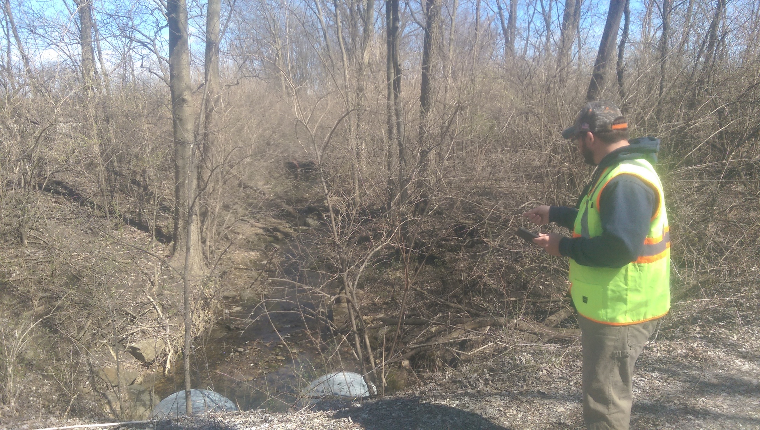
Joe using Esri's Collector app to complete a culvert inventory for LaSalle County, IL
While climbing into and out of the work van, then up and down ravines, through thick thorns and briers to locate the culverts under county roads, I can not stress how beneficial it was to only have to carry in an iPad. Often times the surfaces I was traversing were slick from water, mud, or moss. Having to carry in limited material, freed up my hands for a safer approach and handholds. Once I was at the culvert, I could pull up the exact location, drop a point and begin the inventory. In addition to having drop down menus for various features of each culvert, I was also able to take a quick photograph and attach it to the point, which gives even more detail about the infrastructure.
I can rant and rave about the greatness of this tool, but the best way to understand how powerful it is is to see it in action. We at Cloudpoint would be happy to give you a demonstration and work with you to see how your organization could benefit from implementing Esri's Collector app. It's a great way to manage your infrastructure while streamlining your workflow, and we'd be thrilled to help you accomplish those tasks!
