

Hoops Tracker is a Esri Story Map that displays information for the 2018 Class 1A and 2A Boys Basketball Tournaments in separate web mapping applications, paired with a view of IHSA's interactive ScoreZone web page and other IHSA links.
GIS Tips & Tricks
We have lots of good ideas.
Our range of expertise is not limited to local government: GIS training, avoiding angry Bulls, fishing in Wisconsin. Our Blog will keep you entertained and learning.
Hoops Tracker is a Esri Story Map that displays information for the 2018 Class 1A and 2A Boys Basketball Tournaments in separate web mapping applications, paired with a view of IHSA's interactive ScoreZone web page and other IHSA links.
Earlier in my life, I never ran. I mean from bears, sure, probably I would have. I occasionally played a round-ball-type sport that required moving arms or legs quickly. If I had to actually run, I hated every second and would never consider running for health. Well, circumstances change and different things matter as you approach mid-life. Two years ago I found...
Our travels here at Cloudpoint take us to many places throughout the state of Illinois (as well as many other states). In the spirit of our connections to the Prairie State, as well as our varied tastes in music, here is a Story Map that focuses on a selected set of songs that contain Illinois place names in their titles-The Prairie State Playlist.
The Prairie State Playlist is constructed using Esri's Story Map Journal template. Maps of each location comprise the "Main Stage", while information and a link to the song are in the "Side Panel." The maps for the Prairie State Playlist were created in ArcGIS Online as webmaps, and then converted to apps using Web AppBuilder, which allows for a better interface and the inclusion of widgets such as a Legend, Basemap Gallery, etc. The webmaps alone can also be included as content in the Story Map, as well as videos, images, and web pages.
Please browse the Prairie State Playlist and enjoy the music tour through the Land of Lincoln. Along the way, you might pick up some information about Bob Dylan, Tornadoes, and an EPA Superfund site.
The Illinois High School Association are purveyors of America's Original March Madness, holding basketball state finals since 1908 (Peoria High was the first champion). The University of Illinois had a longstanding tradition of hosting the boys basketball tournament, and the Assembly Hall provided the backdrop of my first memories of watching March Madness on television, as well as the first time I attended in ...
Below you'll find an article in our local paper from Journalist Cheryl Wolfe of the Pantagraph papers in Bloomington, Illinois. She did a fantastic job and we wanted to include her article in our blog as a "Thanks!".
(Reprinted with Permission)
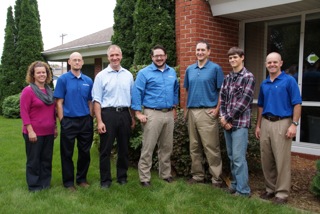
ALL MOVED IN--Employees at Cloudpoint Geographic, Inc. are: (left to right) Jodi Hoffman, Paul Stephenson, Micah Williamson, Joe Christian, Matt Junker, Tyler Severson, and Jonathan Hodel
Hodel plans open house
CHERYL WOLFE
cwolfe@mtco.com
ROANOKE—These days, Jon Hodel often has his head in the clouds and is always thinking higher.
When office space for his growing business, Cloudpoint Geographics, Inc. got too small, Hodel started looking for something bigger. He found it, just a block away in the building that formerly housed Dr. Michael Meier’s dental office.
A building with several smaller rooms might not fit the needs of most businesses, but for Hodel and his employees, it was literally a godsend.
“This office has been a perfect fit for us,” Hodel said of the building. “The Lord provided for us; we couldn’t have asked for a better fit.”
Hodel said it was getting crowded in his old office on Main Street, but now all employees have their own space, in addition to a conference room and a kitchenette. And, the move kept Hodel’s business in his hometown, just where he wants it to be. There was a time when Hodel was thinking of re-locating to another town because he could not get enough high speed Internet service in Roanoke, a service that is vital to his business. But he recently found a way to get by with the service in place.
“We don’t have fiber yet due to the cost, but we’re using the Amazon cloud, and we’re getting by for now,” Hodel said. “We have seen increased efficiency, and cost savings came into play.”
Most people don’t really understand the kind of work Hodel does unless they are very technologically savvy. Hodel is a licensed professional engineer and certified Geographic Information System (GIS) professional. His business started with him, by himself in an office with a laptop, and grew to where it is today with one part-time and five full-time employees. Their work includes GIS mapping for government utilities and public works and asset management, among other projects. Simply put, they make maps, Hodel said. But the maps are not simple.
GIS maps are detailed and made using satellite technology. They allow clients to visualize, question, analyze and interpret data to better understand patterns and trends, as well as what is happening in geographic space. They are also valuable in creating and maintaining more accurate records.
There is a growing interest and awareness of the economic value of GIS. It can be used to manage assets, such as the life expectancy of streetlights or to schedule garbage truck routes to maximize efficiency in fuel and labor. Cloudpoint performs both small jobs and big ones, like a utility mapping job in Mendota that has taken all summer.
These descriptions are only a fraction of the work that Cloudpoint is capable of doing, and they barely scratch the surface of what will be available in the future. Hodel said drones will be used as a powerful commercial tool in the future pinpointing a number of things, from agriculture applications to other commercial uses. He plans to be a part of that technology as it is implemented.
”We’re really excited about the new technology drones will bring,” Hodel said. “It’s fascinating. I really enjoy new things. It’s the engineer coming out in me.”
Hodel said he hopes to hire a licensed pilot to work with drones in the future to create another arm of his business.
The work of Cloudpoint Geographics is far above most of the public’s head, so getting his name out and helping others learn about the services he provides to gain new business is sometimes challenging.
“We find we do a lot of door knocking, and use our web presence,” Hodel said. “Most of our business comes from referrals or face-to-face marketing.”
Hodel wants to do a little face-to-face marketing with the people of Roanoke where he has lived most of his life. He has invited them to come see his new office during an Open House, on Friday, Oct. 2, from 4-6 p.m. He will be glad to explain some of the fascinating aspects of his work to anyone who is interested. And, he wants everyone to know how much he enjoys his new office in Roanoke.
“We’re really happy to be here,” Hodel said.
Statue of Wild Bill Hickok in Mendota, IL.
Being lucky enough to be from the great state of Illinois and having a long lineage of ancestors who called the Prairie State home before me, I have a deep connection to the land and a pride of the heritage and history that the state embodies. While completing field work in the town of Mendota, IL, I noticed a large metal statue in the town square. Not ever being to the town before, I decided to go check it out. Upon inspection I learned that it was a bronze statue of James "Wild Bill" Hickok, a native of nearby Troy Grove, IL. This struck me as fantastic and I decided to dig deeper to see what other famous cowboys, lawmen, and sharpshooters were from Illinois.
I knew that the legendary lawman Wyatt Earp was born in and once called the Western Illinois town of Monmouth home, but I didn't know the vast connection of Wild West names that either were born in or spent time in the Land of Lincoln throughout the 1800's. Once i compiled a list of several men, I realized that I had to find a way to visualize my state's history that showed how interconnected it was to the vast frontiers and mountains of the American West. The best way for me to do that was by creating a story map via ESRI's ArcGIS Online story map builder.
You can view the map by clicking HERE. The process was relatively easy and pretty fun to put together. As you look at the map you will notice that the locations have one of three different colors for the tag: blue are for lawmen who once called Illinois home, red are for criminals that have ties to the state, and green is for a man of a completely unique professional background all his own.


