

Jonathan Hodel, P.E., GISP
Principal
In today’s rapidly changing world, effective utility management is essential to ensure a reliable supply of services such as water, electricity, and telecommunications. Campuses such as universities, hospitals, and local governments are often overwhelmed with the amount of utilities that lie in small areas or narrow corridors. Geographic Information Systems (GIS) has emerged as a powerful tool that enables utility companies and organizations to optimize their operations, improve decision-making, and enhance overall efficiency. This blog will explore the various ways that GIS, and specifically the ArcGIS platform, is transforming the way that utilities are managed across campus, from enhancing asset tracking to streamlining field operations and improving disaster response.
The Role of GIS in Utility Management
GIS are specialized technology platforms designed to capture, store, analyze, and present spatial or geographic data. In the context of utility management, GIS integrates location data with information about utility assets, infrastructure, and the environment. It provides a holistic view of a utility network, enabling organizations to make data-driven decisions and efficiently manage their resources.
Benefits of GIS in Utility Management
GIS allows utilities to maintain accurate and up-to-date records of their assets, including pipes, cables, transformers, and substations. This facilitates better asset tracking, maintenance, and life-cycle management. Additionally, field workers can be equipped with mobile GIS applications, allowing them to access real-time maps and data while in the field. They can receive work orders, locate assets, and submit updates, leading to more efficient field operations and improved response times.

1. Centralizing Utility Records
Combining data that is scattered across an organization, including paper records and drawings, is one of the first ways that campuses can find immediate results. The ArcGIS Solutions gallery can be a useful starting point- providing a standard data format or map template to help create a plan to organize data. Some of these solutions are tailored to meet specific needs, such as the lead service line replacement solution. It helps water utilities address the challenge of replacing lead service lines and gives them a central repository for managing those workflows.
Converting CAD layers, scanning blueprints, and collecting data from aerial imagery are the beginning steps to getting utility data into GIS format, then populating the database structure as the system of record. The database structure is an important component to organizing the data in a manner that is useful. It is sometimes referred to as a data schema or an information model.
2. Increasing Spatial Accuracy
There are many different ways that facility managers can improve the spatial accuracy of their data. Those who have a workflow in place to ensure that all newly placed utility lines are accurately measured and incorporated into their GIS system in a timely manner are the clear winners in this area. One of the tricks that successful utility managers find helpful is to collect the data immediately following utility locate activities. WHen utilities are marked or newly constructed, their spatial location can easily be collected with the proper tools, including GPS equipment, drones, laser scanners, or a combination thereof. The cost of this equipment has never been more affordable.
Another workflow consideration is to require electronic submission of utility plans from all contractors. These requirements can include your preferred coordinate system, so the data can be directly imported into your campus GIS maps. Be aware that utilities are almost never placed in the same location as planned. For this reason, it is critically important to validate any as-built plans received with data collected in the field.
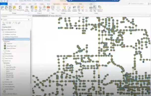
3. Improving Data Quality
To improve data quality, ArcGIS Pro has geoprocessing tools that can help campus GIS managers easily clean up the geometry of their utility lines. Some of these tools involve using map topology for easily maintaining connectivity between lines and points as data edits are made within the GIS layers. Some of these tools are specifically demonstrated in the video reference below. Many campuses also recognize that having their utility data in a managed network, such as the ArcGIS Utility Network solution, gives them more decision-making control over their operations. The ArcGIS Utility Network is being widely adopted by many organizations looking to perform analysis on their networks, such as trace functions, modeling, and reporting. In the event of outages, natural disasters, or emergencies, GIS helps utilities respond more effectively and helps quickly identify affected areas, prioritize restoration efforts, and communicate updates to customers.
The integration of Geographic Information Systems (GIS) into utility management has brought about transformative changes in how campus facilities operate their utilities, manage assets, and respond to challenges. These systems enable them to harness the power of location data, make informed decisions, enhance data quality, and ultimately improve the reliability and efficiency of delivering utility services. As technology continues to evolve, GIS will remain at the forefront of utility management, ensuring a sustainable and resilient future for utility companies and the communities they serve. For more information on the topics covered in this blog post or more detail on many of the mentioned solutions, check out Cloudpoint’s recently recorded webinar, 3 Trends for Improving Campus Utilities, or contact us here.
