
Cloudpoint Geographics is excited to announce another UAV drone mapping project that is in the works. We will be collecting data at Cog Hill Golf Course in Lemont, IL. Some of you golfers out there are familiar with Cog Hill, but for you other folks, Cog Hill is comprised of 4 separate courses and has hosted numerous Professional Golf Association events including 16 Western Opens and 4 BMW Championships. We will be collecting ground control points and high resolution imagery that allows us to create 3D mapping for various applications. This is the 2nd golf course that we have flown and we're pretty certain it won't be the last! It's a good thing we're mapping the golf course, because that's what we do. If we were golfing at Cog Hill, there'd be several lost balls and more than a few announcements of "FORE!"
Hodel & Knapp pass the Unmanned Aircraft General (UAG) Exam
CLOUDPOINT GEOGRAPHICS TAKES TO THE SKIES
Cloudpoint Geographics forms strategic partnership with Kovar & Associates, LLC to offer aerial mapping services using drones
Roanoke, IL, February 15, 2015– Cloudpoint Geographics is pleased to announce a partnership with Kovar & Associates LLC to offer professional aerial mapping services with UAV's (drones). Mr. Kovar is a licensed fixed wing and rotorcraft pilot and specialized cyber-security consultant. He has been involved in disaster response and search and rescue for over 15 years and has a passionate interest in mapping and imagery due to this experience.
“This strategic partnership positions us for an early entrance into a brand new market that will dramatically expand our geospatial offerings throughout the state of Illinois and the Midwest region.” says Cloudpoint president, Jonathan Hodel
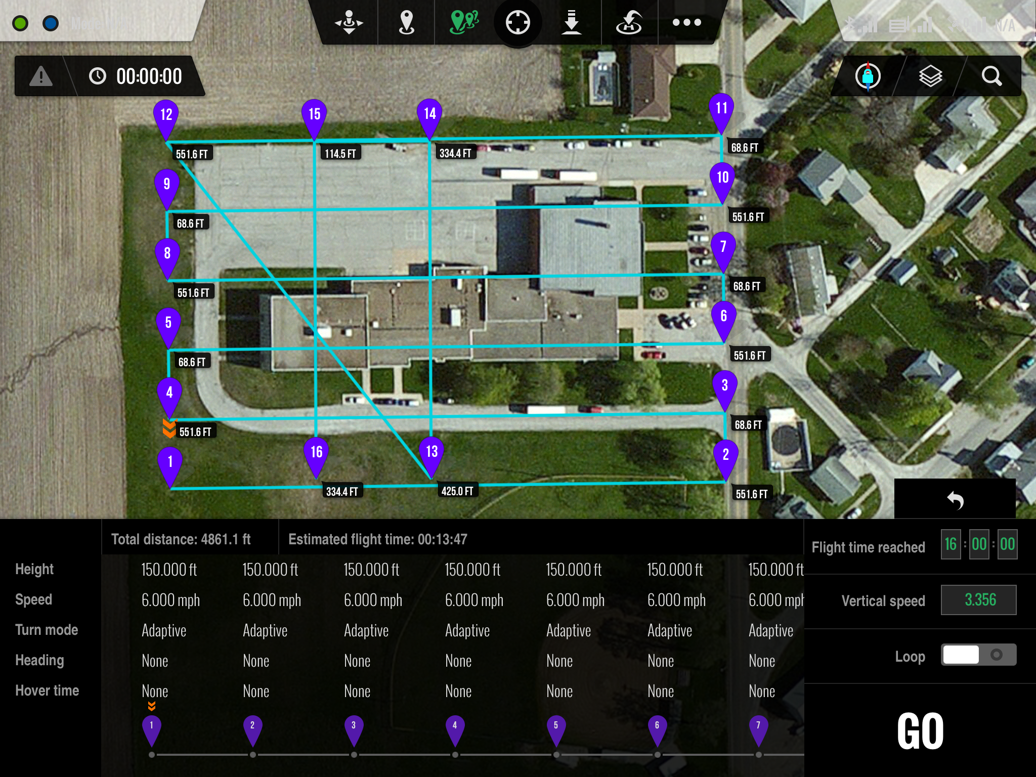
Ground Station iPad interface
The Cloudpoint / Kovar team has submitted a request for an exemption with the FAA to allow for commercial drone operation for aerial mapping. The approval process is anticipated to take several months however these firms are committed to establishing a safe and effective program for using this technology. The FAA is currently in the process of developing regulations for commercial use of drones in many different applications.
Cloudpoint is a dynamic geospatial solutions consulting firm providing mapping and GIS services for a variety of clients.
