There is a major transition of facility managers and campus organizations across the globe who are shifting to GIS as their preferred choice of campus and facility mapping. Time and time again we are hearing about them getting tired of dealing with enormous CAD files with hundreds of layers as they try to manage facilities and campus construction activities. In this article we intend to point out some clear benefits of using Points of Interest (POI’s) within your campus GIS data to enhance the user experience. Specifically we will look at this within the use of Esri’s ArcGIS Indoors solution which specializes in making the conversion from CAD and BIM files into GIS as seamless as possible. Now with ArcGIS Pro users can import BIM files directly into GIS format and take advantage of the rich 3D environment that BIM while enhancing the experience with GIS attribute data and functionality. And as Cloudpoint founder and president, Jon Hodel, says “POI’s are the nerve endings of the routing & wayfinding nervous system”. You can’t effectively route users to locations inside buildings and facilities without first having end points for destinations.
“POI’s are the nerve endings of the routing & wayfinding nervous system”- Jon Hodel
POI’s are no longer places on a large scale map who’s sole purpose is to attract tourists to stop by and spend a few dollars. For example, POI’s now represent places that visitors or facility managers might need to engage with for referencing information, routing and wayfinding, or managing resources throughtout their facility or the entire campus as a whole. POI’s are first organized by large category groups and then broken down into more detailed subtypes. Here are some examples of Points of Interest within the Places and Things category that are common to Facility mapping in GIS:

When deciding on the whether to include a feature within your POI’s, you can think of the anacronym “PROVED” as described below:

Permanence- How permanent is the object of feature. Will it move periodically?
Routability- How important is it to route users to this location?
Operability- Is this feature something that needs to be operable and inspected to maintain operability?
Valuable- Does this feature represent something that is of high-value that needs to be monitored, checked, or requires frequent maintenance?
Emergency- Is this feature a critical in the event of an emergency such as a gas shutoff?
Dependencies- Are there systems of other features or functions that are dependent upon this location such as a doorway for routing and navigation?
For indoor mapping, routing & wayfinding, or asset management needs, POI’s play a key role in helping your users to have a rich and fulfilling engagement with your application. Here is a list of POI categories to get you started on your next indoor mapping and campus facility GIS project.

Cloudpoint can assist your campus organization with creating a campus GIS system from CAD or BIM files or even exploring 3D laser scanning options to update your floorplans. For more information on indoor mapping or ArcGIS Indoors for campus facilities, or to see upcoming webinars on this topic, please visit our website or contact 877-377-8124.
How to Choose which features should be POI’s
Required Information for POI’s in ArcGIS Indoors
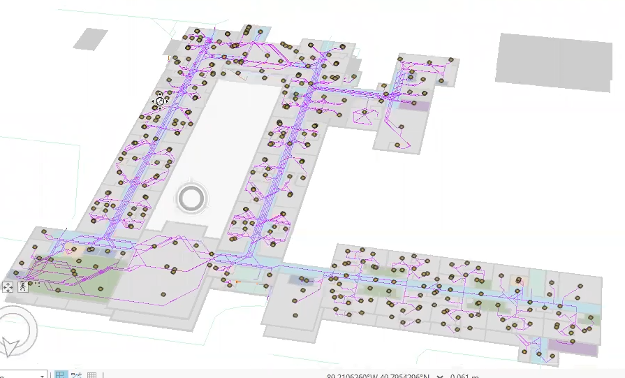
Using Points of Interest in ArcGIS Indoors for ArcGIS Pro
Complete Webinar recording of How Points of Interest Can Enhance Your Indoor Maps. This is part 1 of a 3 part series of Indoors webinars.
