

Daniel Bishop - GIS Project Manager
Coordination with surrounding PSAP territories allows dispatch redundancy and compounds the effectiveness of Next Generation 9-1-1 by establishing a seamless network through agreed-upon boundaries, reviewed borderland addresses, and unified schemas. This work requires communication, agreement, and unified action. This article is meant to help PSAP decision-makers and their counterparts have productive discussions about the perimeter of their NG9-1-1 GIS data.
For those individuals in the midst of migrating their GIS data to the NENA standard and/or working to reduce the dataset error percentage, it is common to feel overwhelmed and uncertain at times. The age-old geographer's challenge of mapping the infinite complexity of reality certainly rings true, especially given a strict national standard. Add to it the responsibility of finding and coordinating with the surrounding entities who may be at different stages of the process with uncertainties of their own, and it’s understandable that the task of synchronizing border data can be daunting. With these sympathies in mind, it’s the hope of this article to provide some general guidance in three parts on how to best organize this coordination work.
Finding People and Sharing Data
Most importantly, find the person or people involved with NG9-1-1 data editing and decisions for each bordering PSAP entity. If a relationship is not already established, this will likely require some exploratory emails. While the bordering entity may be at a different step in establishing their NG9-1-1 GIS data, it is integral to this work that communication between data editors and decision makers be made possible. Along this same line of thought, data must also be shared between the entities to allow coordination. Therefore, any policies preventing data sharing need review and change. Depending upon the state and its policies, there may be a centralized hub of data that provides a clear location to share and receive data.
Feature Coordination Priorities
In order to make the coordination process as efficient as possible, it’s recommended that focus be paid to the relevant features in the following order:
PSAP/Provisioning Boundary
Emergency Response Areas
Road Centerlines
This is simply because all response areas and centerlines must be encompassed by the PSAP and Provisioning features.
Road Centerline Coordination Options
While roads that enter and exit the PSAP boundary perpendicularly simply must end at the PSAP/Provisioning boundary, for roadways that run along and overlay the boundary there are three options for data editors to make the centerlines comply with the NG9-1-1 standards.
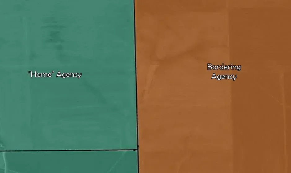
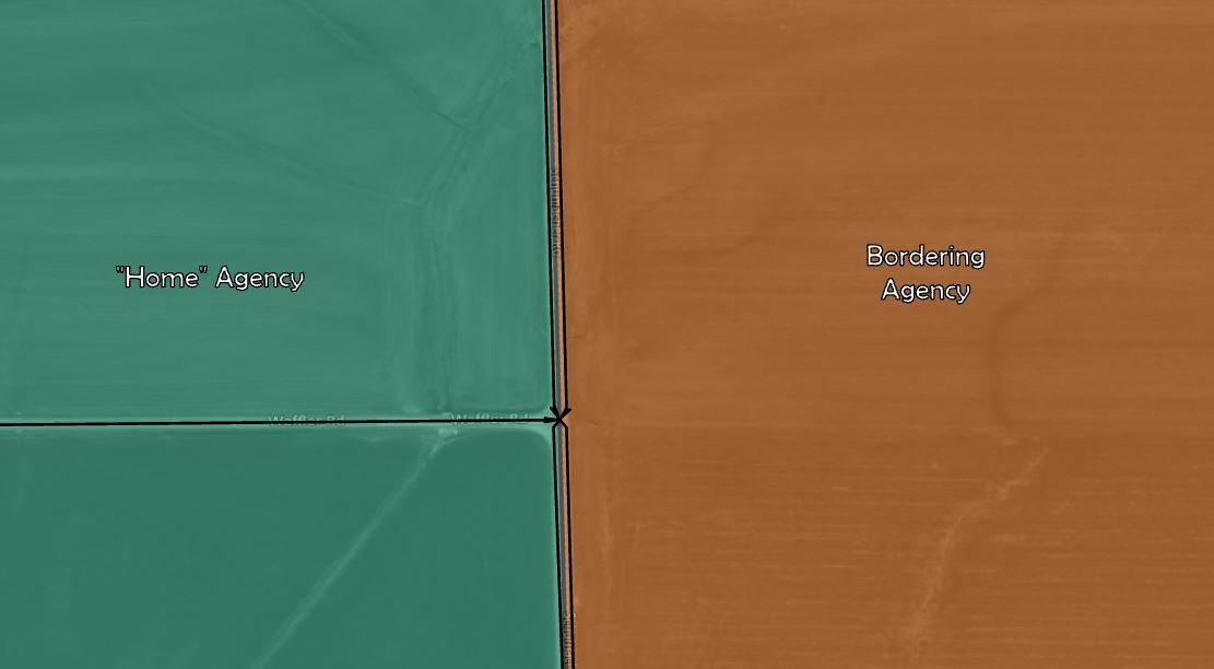
Coincident Centerlines Method
This technique requires centerline geometry be identical (stacked) for both jurisdictions. The "home" PSAP entity, in this example with jurisdiction on the hypothetical left side, should populate attributes appropriate to the left side of the road – i.e. “incorporated municipality left”, “county left”, “left from address”, “left to address”, etc. Conversely, the hypothetical right side of the centerline should contain no range values, the “validation right” field should be populated with a value of “N", and the “incorporated municipality right” and/or "county right" fields should contain the appropriate jurisdiction name of the bordering PSAP entity.
Parallel Centerlines Method
With this method, address range and validation attributes are populated the same as in the above Coincident Centerlines method, but the centerline geometries for each jurisdiction run parallel to one another, each fully within their respective PSAP boundary. Therefore, each centerline is populated with the same Incorporated Municipality on its right and left side as it falls within the jurisdiction it represents.
Singular Upload
Alternatively, if the road name is the same for both jurisdictions, both parties could coordinate to populate the roadway attributes for each side of the centerline with the respective jurisdiction’s address ranges, municipalities, counties, etc. The centerline geometry must also be identical – as in the above Coincident Centerlines method. If these conditions are met, one of the two jurisdictions can take on the responsibility of uploading the particular border centerline data.
As always, Cloudpoint’s professionals are available to discuss how we can help you and your organization meet the requirements of Next Generation 9-1-1.
References:
NENA Information Document for GIS Data Stewardship for Next Generation 9-1-1 (NG9-1-1); https://cdn.ymaws.com/www.nena.org/resource/resmgr/standards/NENA_INF_028.1_2020_GISDataS.pdf
Minnesota Geospatial Advisory Council Road Centerline Data Standard; https://www.mngeo.state.mn.us/committee/standards/roadcenterline/MN_GAC_Road_Centerline_Data_Standard.pdf
