
Piqua, Ohio is a city of more than 20,000 people in west central Ohio. Providing municipal services for a city of that size requires GIS utility data that is readily available, current, and dependable. City staff needs to know where underground assets are, when they were built, and when they were last inspected, cleaned, or replaced.
For years, the City of Piqua maintained its utility data using ESRI’s Geometric Network geodatabase model. The data was updated using ArcMap. While that model served the purpose of getting the data into the digital world, the Geometric Network was functionally lacking for some of the city’s needs. Perhaps the biggest shortcoming was that Geometric Networks are a read-only dataset in ArcGIS Pro. With the deprecation of ArcMap, the push to move into the new ArcGIS Pro environment became a priority.
Alongside functional limitations with their GIS utility features, concerns arose regarding the quality and accuracy of the data. As-built drawings were hard to access and poorly integrated or linked to the GIS features. The city was looking for the ability to click on a GIS feature and easily access its related as-built or construction drawings from a mobile device in the field. All of these things made it clear that the time for data migration and upgrade was imminent.
After attaining budget authority, the city’s GIS Manager put together an RFP that set out to accomplish a number of tasks, including:
Carry out a technical review/assessment of the existing GIS utility data.
Conduct a QA/QC and cleanup of all utility layers including, Water, Sanitary, and Storm Sewers.
Attach all relevant construction documents to their related GIS features.
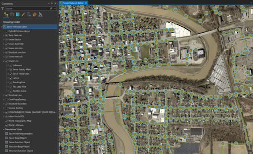
Migrate the data into the current ESRI Utility Network data schema and check for network connectivity issues.
Provide progress reports on each phase of the project.
There were also a few additional tasks the city requested, one of which included a full migration of the Utility Network data into ArcGIS Enterprise.
Cloudpoint Geospatial was selected to provide all of these services for the city based on their breadth of working knowledge with ArcGIS Enterprise and their experience with ArcGIS Pro and other tools. After the project kickoff, Cloudpoint Geospatial set to work populating missing attributes, attaching as-builts, and checking for completeness and connectivity. Once each of the three utility layers is cleaned, linked, and attributed, it will be migrated into the Utility Network data model.
As part of the Utility Network implementation, the city has asked Cloudpoint Geospatial to overhaul their ArcGIS Enterprise deployment, currently hosted in a cloud environment. This entails migrating the deployment from the cloud infrastructure to the City's on-premises environment, facilitating more streamlined management by their IT consultant. Cloudpoint will perform the installation and configuration of ArcGIS Enterprise version 11.1, along with a re-architecture of the deployment aimed at optimizing performance and laying a foundation for future scalability. This migration will enable the hosting of feature services for real-time editing using branch versioning. City staff will use the tools within ArcGIS Pro to update, add, and delete both GIS features and their related attachments. This is a huge step into a much richer data maintenance experience using current tools, technology, and data models.
Prior to their relationship with Cloudpoint Geospatial, the City of Piqua was faced with continuing down the path of maintaining questionable data that wasn’t fully meeting the needs of city staff. Fortunately, the GIS Manager and city officials saw the value and importance of bringing their utility data into a current, sustainable data model and the ArcGIS Enterprise environment. In the end, this data cleanup, enrichment, and migration to the Utility Network, will provide long-term benefits to city staff and residents by reducing data errors, streamlining processes, and positioning their GIS data for the future. Cloudpoint Geospatial is proud to be part of this forward-thinking initiative.
