

Another year has drawn to a close, and while it may not have run it’s course like we thought it would, our team is thankful once again for our continued success. Below are some of our most memorable highlights of the past year:
Keeping Up With Cloudpoint
“It’s not about ideas. It’s about making ideas happen.” - Scott Belsky

Becoming an Esri Business Partner was a key to fueling company growth and opening doors to new opportunities. “Our company’s partnership with Esri has boosted our name recognition and allowed for expertise to be noticed on a national verses regional scale.” says founder and CEO, Jonathan Hodel. Now this partnership blossoms once again as Cloudpoint announces they have received their ArcGIS Indoors specialty designation. This process involves completing an application to Esri and then demonstrating the company’s capabilities for indoor mapping by providing real-world examples of implementing this robust solution. This is the fourth Esri ArcGIS specialty designation that the company has received adding to its current accolades which include Local Government, ArcGIS Online, and Release Readiness designations.
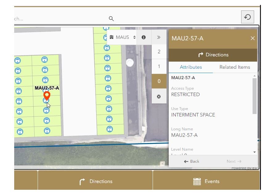
A sample snapshot of indoor mapping application ready to provide asset information or turn-by-turn walking directions. Easily select a building and floor level for easy navigation across a campus. You can image the power of this technology as we mitigate the return-to-work process following the COVID-19 pandemic. Things like space management, foot traffic patterns, route planning, and room cleaning updates can all be tracked via an active Indoor GIS system.
Implementing the ArcGIS Indoors solution across an organization, especially a campus-wide project, requires expertise in several areas of GIS including Enterprise GIS deployment, data conversion of CAD or BIM files, GNSS collection for control points, 3D laser scanning equipment, drone imagery, data curation in ArcGIS Pro, publishing web layers, and more. The Cloudpoint team has experience in bringing all of these capabilities together in a seamless fashion to create an immersive interactive campus experience for the end user.

The end results can be as simple as using Esri’s Indoors web application template along with their Indoors native mobile app, or expanded to include a robust customized GIS interface having the ability to integrate with monitoring sensors and real-time location system (RTLS). For many years, GIS has continued to transform the way people engage with locational data and indoor facility mapping will be the catalyst for engaging in more detail in the future.
For more information on how your organization can harness the power of GIS indoors, visit our Indoors page or contact our team of professionals at 877-377-8124.

