

Jonathan Hodel- Principal
Trimble is a global leader in positioning technology and Esri is a best-in-class geospatial software provider. When these two powerhouses converge, great things happen. So you may be asking, ‘How do I get the best of both worlds from these vendors? Now with Trimble Catalyst, getting high accuracy GNSS positioning integrated with the mobile ArcGIS platform has never been easier.
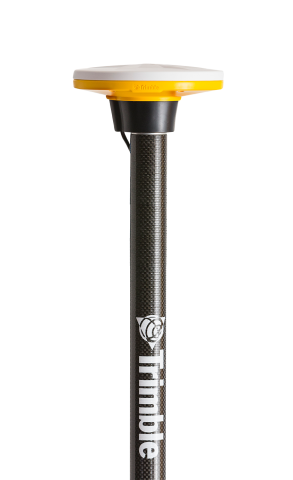
Trimble has released a low-cost, next generation, centimeter grade GNSS unit, called the DA2, that uses their new Catalyst positioning service. In fact, the DA2 is custom-designed to work specifically with Catalyst network, even when users are offline. Trimble® Catalyst™ is a revolutionary GNSS concept delivering positioning-as-a-service to Android™ and iOS devices. With the addition of the simple, lightweight Trimble DA2 GNSS receiver and an on demand accuracy-based subscription, a smartphone or tablet can be turned into a precision mapping, navigation, and measurement tool that can be used with any location enabled app or service.

ArcGIS Online is Esri’s flagship cloud-based GIS platform allowing users to build interactive web maps, gain new perspectives, and enhance details as you interact with data, zoom in, and search on the map. ArcGIS Online uses smart, data-driven mapping styles and intuitive analysis tools to build location based intelligence. ArcGIS Online allows an organization to work more efficiently by collaboratively building and using maps. ArcGIS Online allows organizations to share insights with specific people or the entire world. ArcGIS Field Maps is the mobile application used to collect, update, and edit GIS data that resides on ArcGIS Online or within an ArcGIS Enterprise.
So why are these two offerings such a powerful combination?
Accuracy:
Highly-accurate positional data can be streamed directly to GIS users. Gone are the days of collecting in the field, downloading to a PC, and uploading to maps. With direct connectivity to the cloud, data streaming happens seamlessly and immediately.
Flexibility:
With this solution, any smartphone or tablet becomes a GIS data collection tool. Frustrated with Windows mobile? No problem. Connect an Android or iOS device via Bluetooth to your preferred GNSS device. One GNSS receiver can arm an entire department of data collectors that can share a tablet or simply bring their own preferred device.
Mobility:
Trimble’s DA2 is extremely light weight and versatile. Simply bring along your range pole and keep the light-weight receiver in the backseat or even under the seat of your vehicle. When high-accuracy is needed, simply get out the pole, attach the receiver, and away you go. With the DA2’s affordable price, many agencies can now afford to purchase multiple receivers. This means the headaches of inaccurate GIS data positioning layers can be completely eliminated.
Cloudpoint Geospatial is pleased to provide professional service packages designed to help your organization maximize GIS data accuracy, efficiency, and mobility while increasing intelligent, data-driven, decision-making. We have teamed up with our long-time partner, Seiler Geospatial, to offer the latest Trimble GNSS technology and bundling it with our ArcGIS Online Kickstart provides a complete turn-key GIS solution. Implementing or updating your organization’s GIS has never been easier. Contact our team of professionals at 877-377-8124 to help get you started today.
Below are some additional resources and links to help guide you in the right direction.
Esri ArcGIS Field Maps and Trimble R2
Data collection with ArcGIS Field Maps and Trimble R2
Trimble Catalyst YouTube playlist
Seiler Geospatial Mapping Blog
Cloudpoint’s ArcGIS Online Kickstart
Cloudpoint Geospatial is a leading provider of Geographic Information Systems (GIS) solutions for organizations within public works, facilities, land records, utilities, transportation, and engineering sectors. As your trusted Esri business partner, we help people drive intelligent, data-driven decision making. We are here to bring you ArcGIS Enterprise, Online, and Pro solutions delivered through the Esri platform. Our portfolio varies from large asset inventories to big data solutions delivered through the cloud. Contact us to help your organization get the most out of your location-based data!
