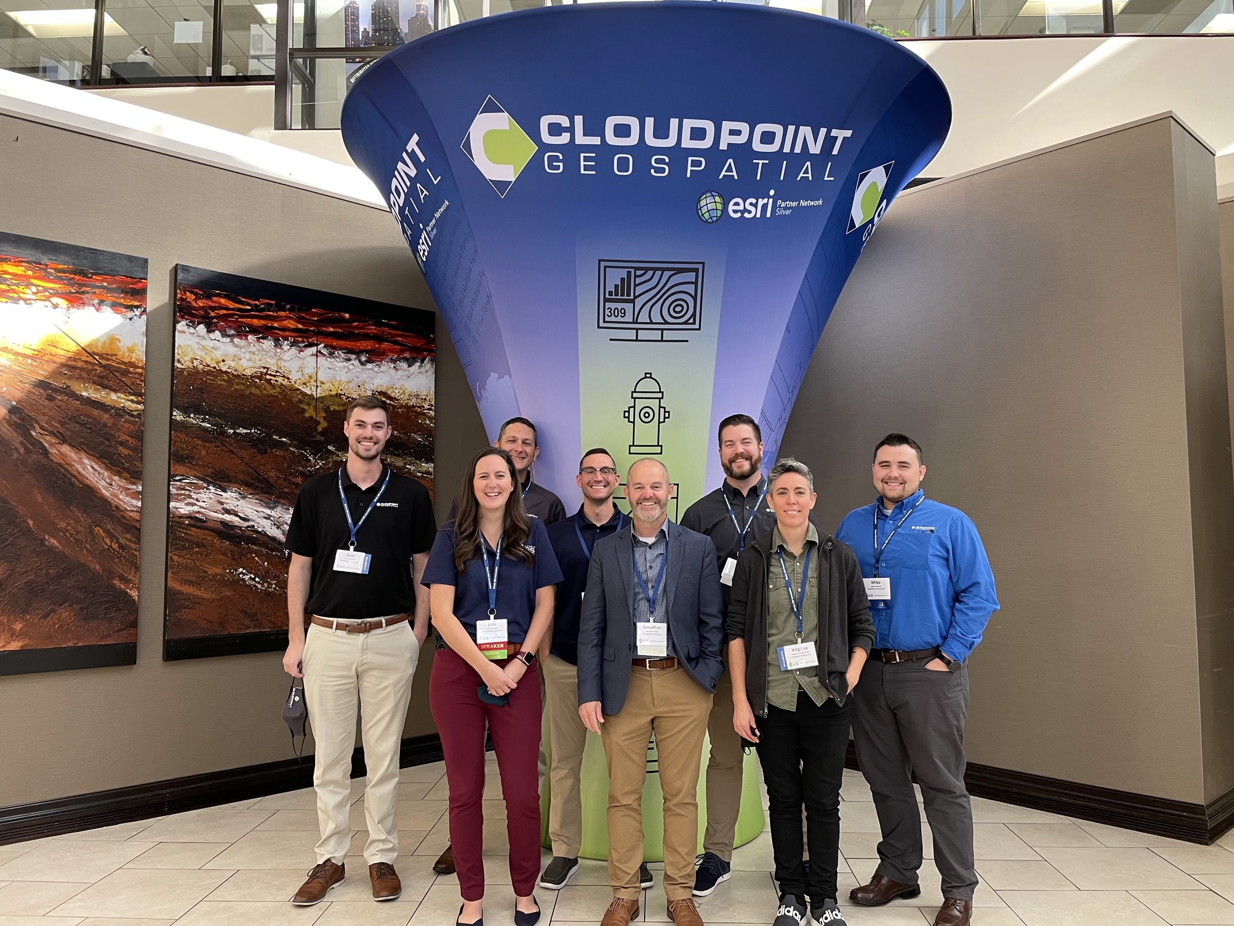
Cloudpoint was thrilled to not only sponsor this great conference and organization once again, but we were also ecstatic to see everyone in-person again! After a trying past year of virtual conferences, getting together again (even with the continued safety of masks) and reconnecting was a wonderful experience…
Cloudpoint providing campus-wide ADA Compliance Survey
Cloudpoint celebrates 10 Years!
Congratulations to the entire Cloudpoint Geospatial team on celebrating their 10-year anniversary of providing professional GIS services. The company was originally incorporated on August 25, 2011 soon after founder Jonathan Hodel, entered the tech startup world when he built a website, sent out letters, and began evangelizing the power of GIS technology. Since then Cloudpoint has…
From Client to Coworker: Daniel Bishop
New GIS Webinar Schedule Released for 2021
Best wishes Micah!
Forrester names Esri a leader in location intelligence
The Forrester Wave is a guide for buyers considering their options in the technology marketplace. To offer an equitable process for all participants, Forrester follows a 30-criterion, publicly available methodology. Identifying the nine most significant location intelligence platforms, they placed Esri at the top, ahead of…
Cloudpoint earns Designation as Indoor Mapping Specialist
Becoming an Esri Business Partner was a key to fueling company growth and opening doors to new opportunities. “Our company’s partnership with Esri has boosted our name recognition and allowed for expertise to be noticed on a national verses regional scale.” says founder and CEO, Jonathan Hodel. Now this partnership blossoms once again as Cloudpoint announces they have received their ArcGIS Indoors specialty designation. This process involves completing an application to Esri and then demonstrating the company’s capabilities for indoor mapping by providing real-world examples of implementing this robust solution. This is the fourth Esri ArcGIS specialty designation that the company has received adding to its current accolades which include Local Government, ArcGIS Online, and Release Readiness designations.
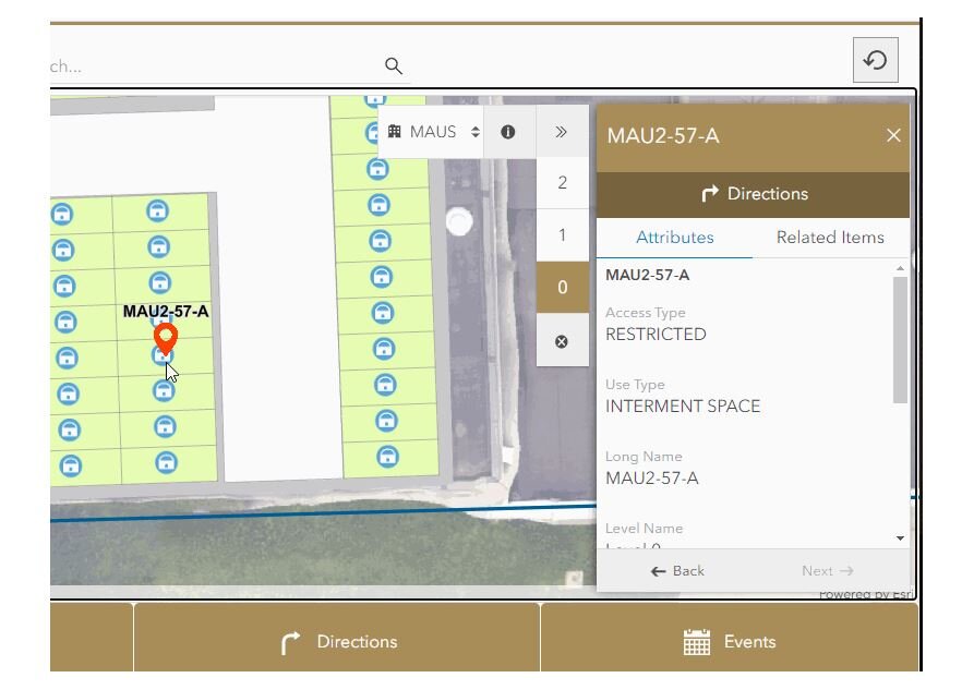
A sample snapshot of indoor mapping application ready to provide asset information or turn-by-turn walking directions. Easily select a building and floor level for easy navigation across a campus. You can image the power of this technology as we mitigate the return-to-work process following the COVID-19 pandemic. Things like space management, foot traffic patterns, route planning, and room cleaning updates can all be tracked via an active Indoor GIS system.
Implementing the ArcGIS Indoors solution across an organization, especially a campus-wide project, requires expertise in several areas of GIS including Enterprise GIS deployment, data conversion of CAD or BIM files, GNSS collection for control points, 3D laser scanning equipment, drone imagery, data curation in ArcGIS Pro, publishing web layers, and more. The Cloudpoint team has experience in bringing all of these capabilities together in a seamless fashion to create an immersive interactive campus experience for the end user.
The end results can be as simple as using Esri’s Indoors web application template along with their Indoors native mobile app, or expanded to include a robust customized GIS interface having the ability to integrate with monitoring sensors and real-time location system (RTLS). For many years, GIS has continued to transform the way people engage with locational data and indoor facility mapping will be the catalyst for engaging in more detail in the future.
For more information on how your organization can harness the power of GIS indoors, visit our Indoors page or contact our team of professionals at 877-377-8124.
A Name That Says It All!
Cloudpoint has gone through various internal changes so far this year; from adapting to remote work, to investing in AWS services to optimize our use of ArcGIS Indoors and Enterprise, to expanding our virtual training efforts with free webinars. After much consideration by the team, we are ready to publicly announce our new name as Cloudpoint Geospatial. This new name better describes the services that we provide and more accurately encompasses our overall purpose. Included in this blog is a video announcement of our company founder, Jonathan Hodel, welcoming on this exciting change and explaining the why behind it.
We hope you’ll take a second to watch our announcement video.
Even though our name has changed, we still strive to fulfill the same mission and purpose.
Our Mission:
Find fulfillment in serving people throughout the world by teaching them the value of spatial data and utilizing it to enhance each other’s daily lives.
Our Purpose:
We are here to provide tools & services that enable organizations to make informed, data-driven decisions based on spatial location.
Cloudpoint Now Offering Services Living up to its namesake
It’s rather interesting, some of the comments we get about the name of our company when people are first introduced to us. They say “Cloudpoint, hmm, is that some kind of cloud-based service, do you work with point clouds, etc.?” As company founder Jonathan Hodel notes, “when we started up in 2011, my wife, Megan and I were discussing several options for names and wanted something that spoke to the technology we are using. As a geospatial company, I knew point clouds were a key part of the services we were offering but at the same time ‘the cloud’ was becoming a popular way to store, manage, and process data.” Proof of this can be found in the fact that company adopted use of the cloud as a way of doing business right from the start.
Using file storage services like Dropbox and Google Drive, then in 2012 becoming an Esri Business Partner and launching its first ArcGIS Server environment in a completely cloud-hosted environment on Amazon’s AWS platform, Cloudpoint is putting its money where its name is. Hodel states, “I like to be able to tell people we’ve never actually ‘owned’ a server and have never had a box in the back room”. At first hearing this, you might think they’ve saved tons of money on hardware and networking costs over the years, however that’s not necessarily the case as the company has invested almost $50,000 in AWS services alone between Elastic Compute Cloud (Amazon EC2’s), S3 storage, and Workspaces. Now the company uses multiple AWS EC2 servers for tasks such as testing and deployment of new ArcGIS Enterprise software packages, project work needing multi-editor environments, and even staging environments for new applications such as Esri’s ArcGIS Indoors.
Now the company is excited to announce its latest service offering of cloud-hosted GIS architecture for organizations looking to migrate their GIS network into a secured cloud environment. Customers can even pair this offering with Cloudpoint’s managed services to have a complete, turn-key Enterprise GIS solution allowing them to focus on their end-user applications and workflows. With this approach, Cloudpoint will launch, deploy, and maintain your complete GIS server architecture in Amazon’s AWS cloud environment giving you as much or as little involvement as you prefer. Yes, that’s right, no need to worry about future server upgrades, monitoring logs, or up-time statistics. Isn’t it time to be done with ‘boxes in the back room’? Contact their professional services or call 877-377-8124 for a brief consultation to see if migrating to the cloud is right for you.


